Downtown aerial

1965

Downtown aerial

0 0 

USA USA > California > Los Angeles County > Los Angeles
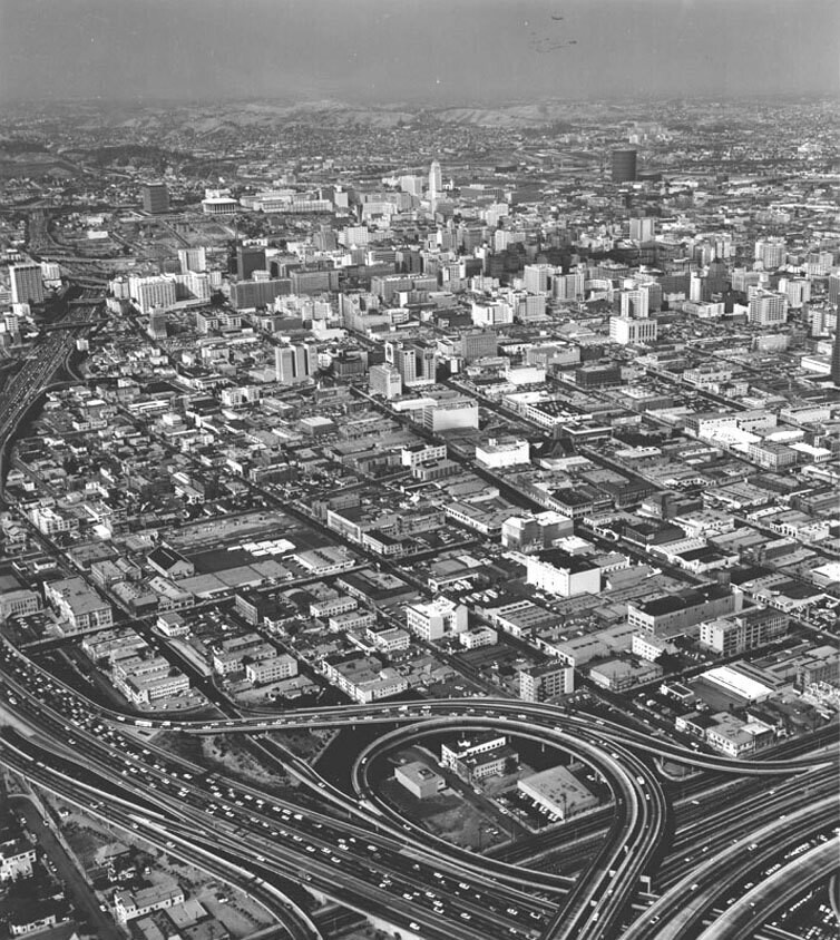
Aerial view of the Civic Center, dated June 17, 1965. View is toward the north, with the interchange between the Harbor and Santa Monica freeways in the foreground.
Kommentarer (0)


Tilmeld dig eller login for at kommentere og bidrage til fællesskabet 

avatar

emmmma 
746 billeder

Bellflower stationPup cafeView of the Potomac River taken from the Madeira School groundsRailfan special on the West Side freight line at the Nabisco building on 10th AvenueApple Valley Inn


Nærliggende billeder

Georgia Street Receiving HospitalOtsego ApartmentsOtsego ApartmentsRoger Young Center's Tabard Inn exteriorMansion Moves Out Ahead of Wrecker's BallConvention Center expansion projectFigueroa Street at Venice BoulevardDowntown from freeway interchangeDowntown from the Patriotic HallPatriotic Hall

Foto offentliggjort på
 25/10/2019 02:19


© Security Pacific National Bank
Alle rettigheder forbeholdes

Billedet anvendes under "Fair Use"-betingelser


Gamle billeder af Los Angeles,Gamle fotografier af Los Angeles,Gamle billeder af Los Angeles,Gamle snapshots af Los Angeles,Gammel panoramaudsigt over Los Angeles,Gamle aftryk af Los Angeles