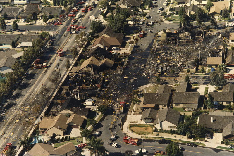
Aerial of Aeroméxico Flight 498 crash site
1986
0 0
 Vereinigte Staaten > California > Los Angeles County > Cerritos
Aerial view showing the neighborhood around Holmes Avenue and Reva Circle in Cerritos hit by the wreckage caused by the mid-air collision between Aeroméxico Flight 498 and a Piper PA-28-181 Archer plane. The collision killed 67 people aboard both aircraft and 15 people on the ground. Photograph dated August 31, 1986.
Kommentare (0)
Registrieren oder Anmeldung um Kommentare abzugeben und zur Community beizutragen


Fotos aus der Nähe


Bild unter "Fair Use"-Bedingungen verwendet