Bundy Drive turns into Centinela Avenue
1956
POPULAR
0 0
 Vereinigte Staaten > California > Los Angeles County > Los Angeles
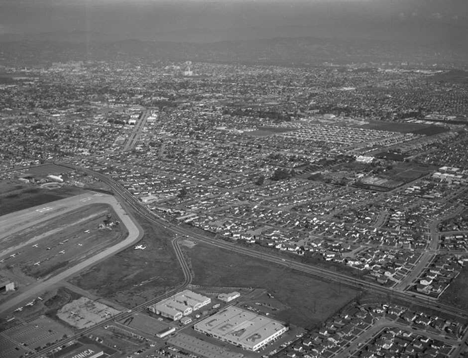
Aerial view of Santa Monica view is looking northeast. Photograph shows the vicinity of Santa Monica Airport (forefront) with Bundy Drive (mid-left to lower right). Ocean Park Boulevard is visible on upper left (jagged, double-lane street) National Boulevard lies mid-photo (horizontal tree-lined street, mid-photo to upper right) the wide street on the extreme right (curved) is possibly Stanwood Drive. Bundy Drive turns into S. Centinela Avenue once past Stanwood Drive. Photographed for Tidewater Oil Association on January 28, 1956.
Kommentare (0)
Registrieren oder Anmeldung um Kommentare abzugeben und zur Community beizutragen


Fotos aus der Nähe


Bild unter "Fair Use"-Bedingungen verwendet