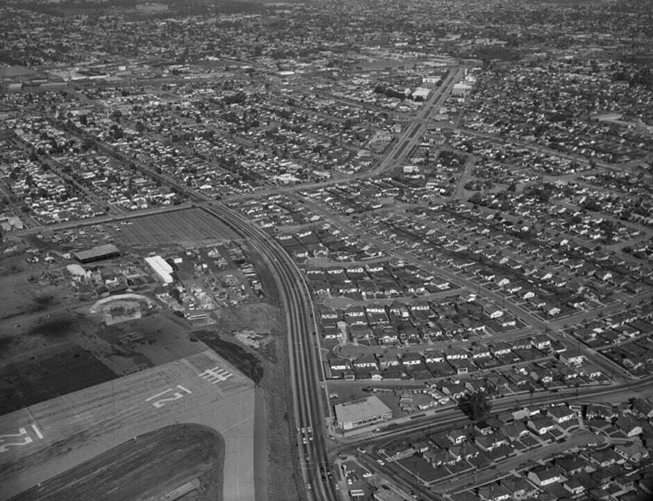
Bundy Drive and Ocean Park Boulevard, looking north
1956
0 0
 United States > California > Los Angeles County > Los Angeles
Aerial view of Santa Monica view is looking north. Photograph shows the vicinity of Santa Monica Airport (left forefront) with Bundy Drive (multi-lane, upper left to lower middle). Ocean Park Boulevard is visible on upper center (jagged, double-lane street) National Boulevard is visible on lower portion (street with with lone tree). Photographed for Tidewater Oil Association on January 28, 1956.
Comments (0)
Register or login to comment and contribute to the community


