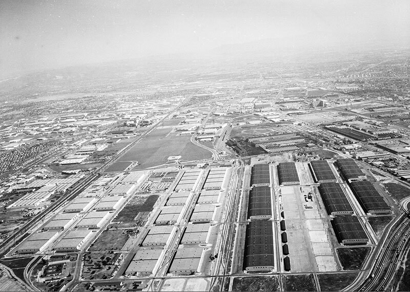
Cheli Air Force Depot, Commerce, looking east
1961
0 0
 United States > California > Los Angeles County > Vernon
Aerial view of Cheli Air Force Depot, located within the Central Manufacturing District view is looking east. Some identifiable areas include: Washington Boulevard, lower left to middle top Atchison Topeka & Santa Fe rail yards, lower left to top middle Bandini Boulevard, vertically up middle and a section of the Long Beach (710) Freeway, bottom right corner Cheli Air Force Station at center right Eastern Avenue, horizontally at middle and Garfield Avenue, horizontally at upper middle. Photograph dated February 24, 1961.
Comments (0)
Register or login to comment and contribute to the community


