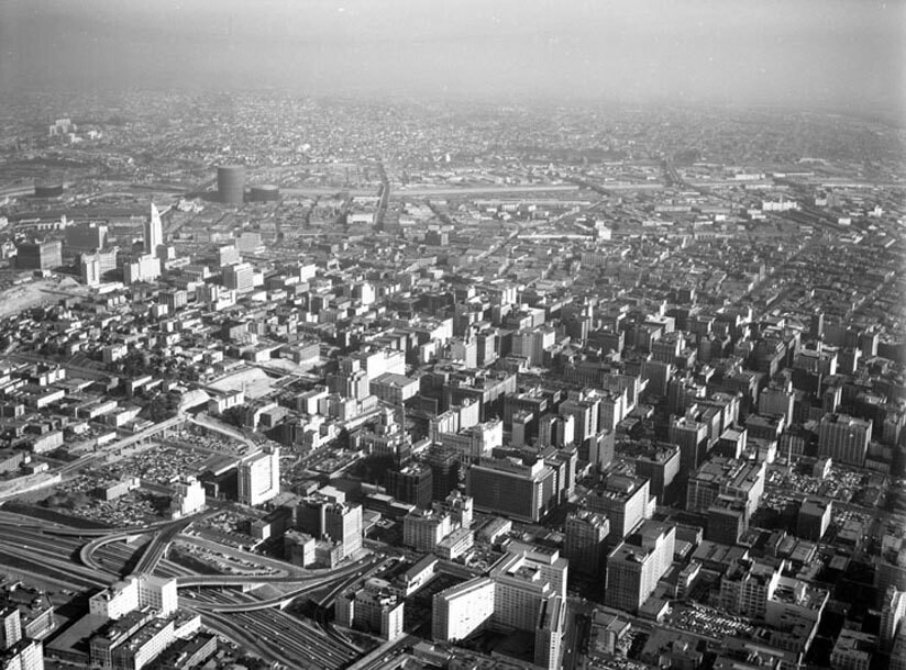
Aerial view of Downtown Los Angeles
1955
POPULAR
0 0
 United States > California > Los Angeles County > Los Angeles
Aerial view of Downtown Los Angeles view is looking east from over the Harbor Freeway (110). The Statler Hilton Hotel, located between 7th and Wilshire and built by Holabird, Root & Burgee of Chicago, is visible on lower middle. City Hall, built by John Parkinson and Albert C. Martin, Sr., can be seen in the distance on the left, and farther still, the Los Angeles River runs horizontally across the top. Photographed for Union Oil Company on October 25, 1955.
Comments (0)
Register or login to comment and contribute to the community


