Early Eagle Rock panorama
1915
2 0
 United States > California > Los Angeles County > Glendale
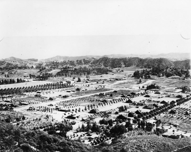
Panoramic view of Eagle Rock valley, as it was known in the 1900s, looking south and east from the hills in back of Hill Drive. Colorado Boulevard, a major east-west thoroughfare, can be seen running along the middle of the photo. The streets running in a north-south direction are possibly (l to r): Dahlia Dr., Townsend Ave., Vincent Ave., Mt. Royal Dr., La Roda Ave., and Argus Drive. Eagle Rock is a neighborhood in northeastern Los Angeles that derives its name from a massive boulder at the district's northern edge. The boulder contains an indentation that creates an eagle-shaped shadow everyday around noon. In the 1880s Eagle Rock existed as a farming community with grand Victorian farmhouses and many exquisite Craftsman homes in charming neighborhoods. In 1906 Eagle Rock became an independent city and was incorporated in 1911 with a population of approximately 600 in 1914 it also became home to Occidental College, designed by famed architect Myron Hunt.
Comments (0)
Register or login to comment and contribute to the community


