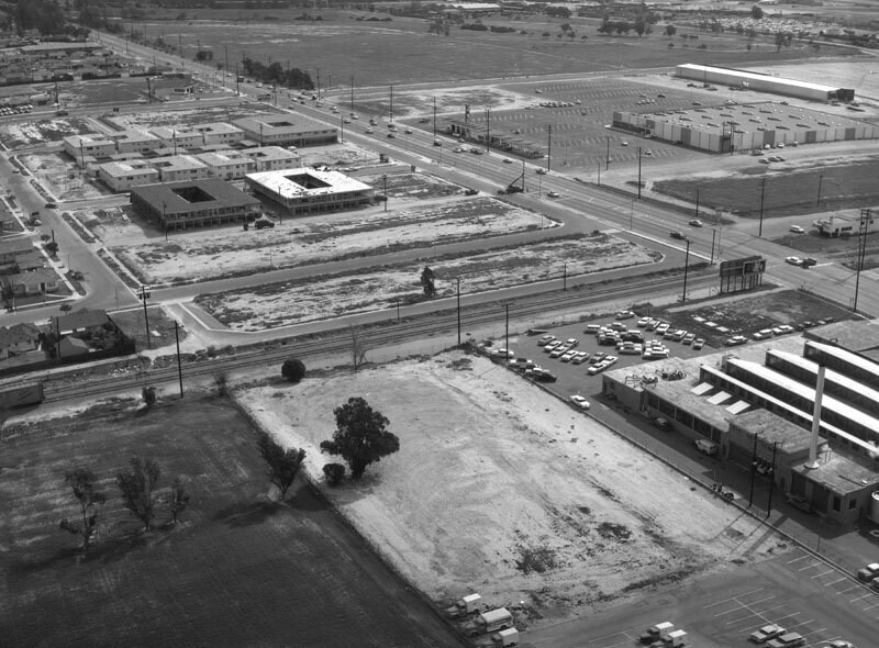
Greenmeadow Road, looking southeast

1960
Greenmeadow Road, looking southeast

2 0 

United States United States > California > Los Angeles County > Long Beach
Aerial view of a lot at the intersection of Carson Street (diagonally, top left corner to middle right) and Paramount Boulevard (diagonally, upper left to top right) corner view is looking southeast. A warehouse with a "Cal" sign is visible at upper right, the Union Pacific Railroad tracks run from lower left to middle right, and a small section of All Souls Cemetery is at forefront. Photograph taken for Meg - Bob Brindle. Photograph dated February 26, 1960.
Comments (0)


Register or login to comment and contribute to the community 

avatar

landon_ice 
833 photos

Las Campanas HospitalIsaac Brokaw house45 East 75th Street. Double red brick residence.449-453 West 123rd Street. The Benmore Apartment HousesEast 86th Street. Christmas tree in wartime, Carl Schurz Park


Nearby photos

Greenmeadow Road, looking southeastDeeboyar Avenue, looking southwestLakewood Drive-In, looking southGreenmeadow RoadGreenmeadow RoadParamount Boulevard, looking southwestLakewood Drive-In, looking southwestGreenmeadow Road, looking southLakewood Drive-In, looking westLakewood aerial

Photo published on
 October 16, 2019 at 11:00 AM


© Howard D. Kelly
All rights reserved

Image used under "Fair Use" conditions


Old photos of Long Beach,Old photographs of Long Beach,Old images of Long Beach,Old snapshots of Long Beach,Old panoramic views of Long Beach,Old prints of Long Beach