Taft, looking north

1955

Taft, looking north

0 0 

United States United States > California > Kern County > Taft
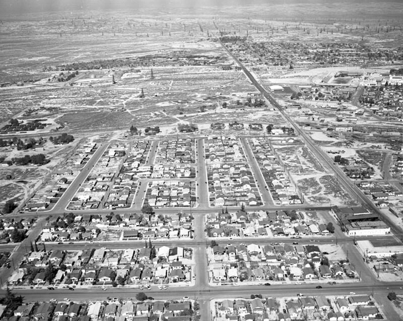
Aerial view shows houses north of "D" Street and west of 10th Street view is looking north. The first street visible at the bottom of the photograph is Philippine Street, followed by (horizontally, traveling up), "B" Street "A" Street, and Pilgrim Avenue and (vertically, from right to left), S. 10th Street, 2nd Avenue, Franklin Street, Lexington Avenue, 3rd Avenue, Woodlawn Avenue, Loma Vista Avenue, and 4th Avenue. Photograph dated March 5, 1955.
Comments (1)

avatar

james_bnd  March 18, 2020 at 08:12 PM

I know that area well


Register or login to comment and contribute to the community 

avatar

nathan70 
1147 photos

193rd Street and Audubon Avenue. George Washington High SchoolSanta Monica AirportC.K.G. Billings EstateWest 106th Street. Home for Aged and Infirm Hebrews.Fifth Ave. Hospital, 5th Avenue and 105th Street


Nearby photos

Downtown Taft10th Street, looking northSafeway Stores Inc., looking northwestSupply Row and Main Street, looking southeastSupply Row, looking southeastTaft Union High School, looking northwest10th Street, looking northLooking south from San Emidio StreetTaft Union High School, looking westAerial view of Taft, looking northwest

Photo published on
 January 11, 2020 at 08:25 PM


© Howard D. Kelly
All rights reserved

Image used under "Fair Use" conditions


Old photos of Taft,Old photographs of Taft,Old images of Taft,Old snapshots of Taft,Old panoramic views of Taft,Old prints of Taft