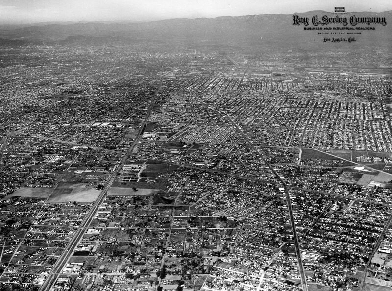
City of Compton, aerial view
1946
POPULAR
0 0
 United States > California > Los Angeles County > Compton
An aerial view of the City of Compton, looking north of El Segundo Boulevard. Long Beach Boulevard is at right, and Alameda is to the left. Photo taken in 1946.
Register or login to comment and contribute to the community


anjel December 7, 2019 at 10:53 AM
I love it!