Aerial view of Los Angeles
1956
0 0
 United States > California > Los Angeles County > Los Angeles
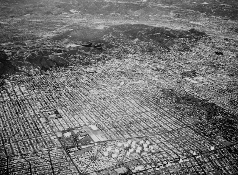
Aerial view of Los Angeles, San Fernando Valley, Hollywood, West Hollywood, Universal City and Toluca Lake view is looking slightly northeast. Some identifiable areas include: Los Angeles River and Griffith Park, top right, Barnsdale Park, extreme upper right Hollywood Memorial Park and Paramount Studios, upper right Brea Avenue, lower right to upper middle 6th Street, lower right to bottom middle Wilshire Boulevard, lower right corner Hollywood Reservoir, upper center Hollywood (101) Freeway, middle right to upper left Warner Hollywood Studios, mid-photo Wilshire Country Club, middle right 3rd Street, middle right to bottom middle Runion Canyon Park, Toluca Lake and Universal City, upper left CBS Television City, Pan Pacific Park, Farmer's Market and Park La Brea, lower middle Fairfax High School middle left Beverly Boulevard, lower left to middle right Melrose Avenue, middle left to middle right Fairfax Avenue, bottom left to middle left. Photograph dated November 14, 1956.
Register or login to comment and contribute to the community


lianela_me February 13, 2019 at 06:31 PM
Evocative