Centinela Avenue, looking south

1956
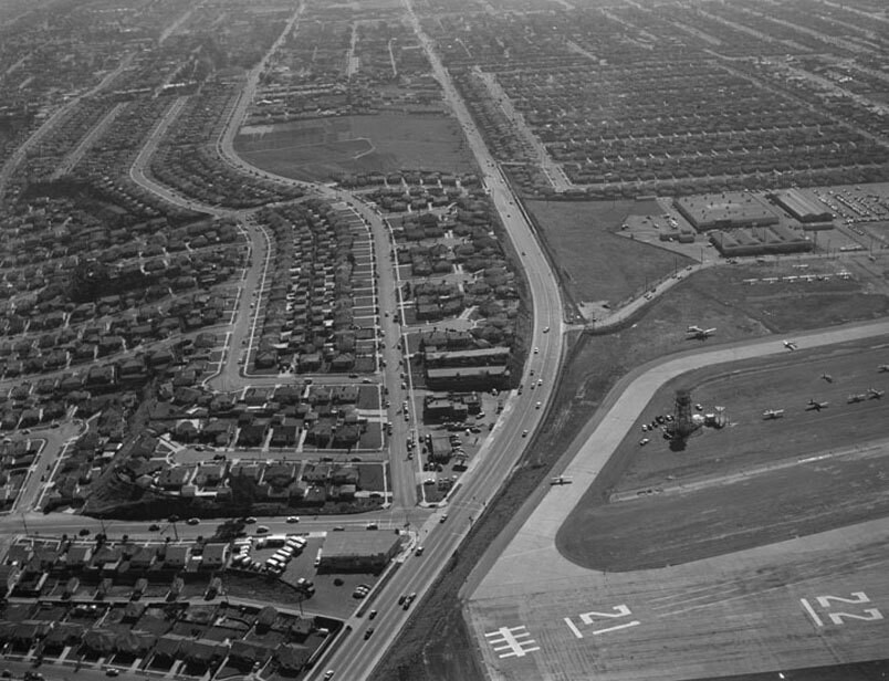
Centinela Avenue, looking south

0 0 

United States United States > California > Los Angeles County > Los Angeles
Aerial view of Santa Monica view is looking south. Photograph shows the vicinity of Santa Monica Airport (forefront) with Bundy Drive (left corner, running up the center). National Boulevard can be seen peeking out from the left and intersecting with Bundy Drive. The curved streets paralleling Bundy Drive are (r to l) Grand View Boulevard and Mountain View Avenue. Bundy Drive turns into S. Centinela Avenue once past Stanwood Drive (curved street next to the large empty plot, upper center). Photographed for Tidewater Oil Association on January 28, 1956.
Comments (0)


Register or login to comment and contribute to the community 

avatar

eli_eli 
756 photos

Times Square, looking southwest, 1953Equitable fire as viewed from the Singer BuildingPacific Design CenterSide view of Rancho Aguaje de la Centinela adobeExpo 74 in Spokane WA 2


Nearby photos

Bundy Drive, Centinela Avenue, looking southSanta Monica Airport, looking from Bundy DriveSanta Monica AirportBundy Drive and Ocean Park Boulevard, looking northBundy Drive and Ocean Park Boulevard, looking northeastWhitaker ranch in Santa MonicaWhitaker RanchBundy Drive, looking northBundy Drive and National Boulevard, looking eastNational Boulevard

Photo published on
 February 3, 2019 at 05:52 AM


© Howard D. Kelly
All rights reserved

Image used under "Fair Use" conditions


Old photos of Los Angeles,Old photographs of Los Angeles,Old images of Los Angeles,Old snapshots of Los Angeles,Old panoramic views of Los Angeles,Old prints of Los Angeles