Mission San Gabriel
1900
0 0
 United States > California > Los Angeles County > San Gabriel
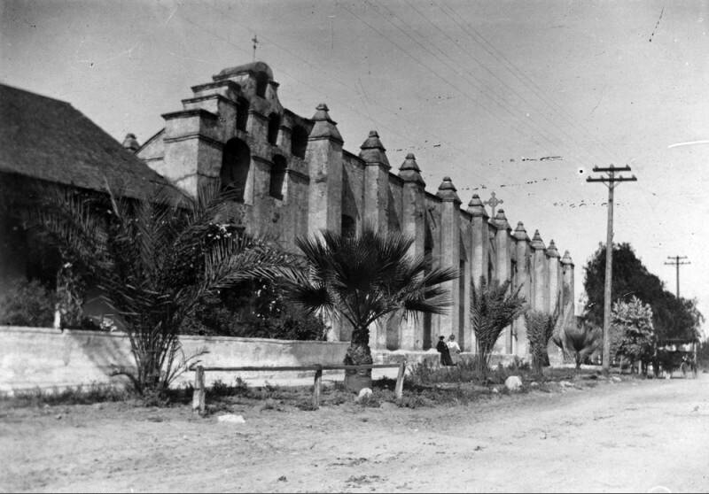
Early view of the six-bell "campanario" (or "bell wall") located adjacent to the chapel's east facade, at the far end of the church, with a thin but ornate cross at the very top. This large six-bell campanario was built after the original three-bell structure toppled during the 1812 Wrightwood Earthquake. In olden times, bells were vitally important to daily life at any mission. The bells were rung at mealtimes, to call the Mission residents to work and to religious services, during births and funerals, as well as to signal the approach of a ship or returning missionary, etc. When this photograph was taken, the palm trees were still saplings and the road had not yet been paved. The dirt road was part of "El Camino Real" - the 600-mile California Mission Trail connecting the former Alta California's 21 missions.
Comments (0)
Register or login to comment and contribute to the community


