Baldwin Hills, post disaster
1964
1 0
 United States > California > Los Angeles County > Los Angeles
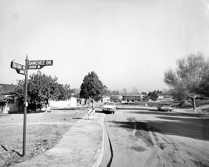
Baldwin Hills Dam flood, post disaster construction, showing the intersection of Sanchez Dr. and Duray Pl., Baldwin Hills. Several dwellings have been rebuilt, though several more lots remain empty. Photograph dated January 23, 1964. On December 14, 1963 at approximately at 3:38 p.m the Baldwin Hills Dam collapsed, spilling 300 million gallons of water into the hillsides that swept away houses and cars and left three dead. Most of Baldwin Village, including the historic Village Green community, was flooded and more than 50 homes were destroyed in the canyon below. The crack in the dam was ultimately attributed to subsidence caused by overexploitation of the Inglewood oil field. The disaster caused the Los Angeles Department of Water & Power to phase out small local reservoirs, opting instead to store water in groundwater basins and behind the Hansen Dam in Lake View Terrace.
Register or login to comment and contribute to the community


singapur4u March 31, 2020 at 08:18 AM
I liked it better that way