Elysian Park landslide
1937
2 0
 United States > California > Los Angeles County > Los Angeles
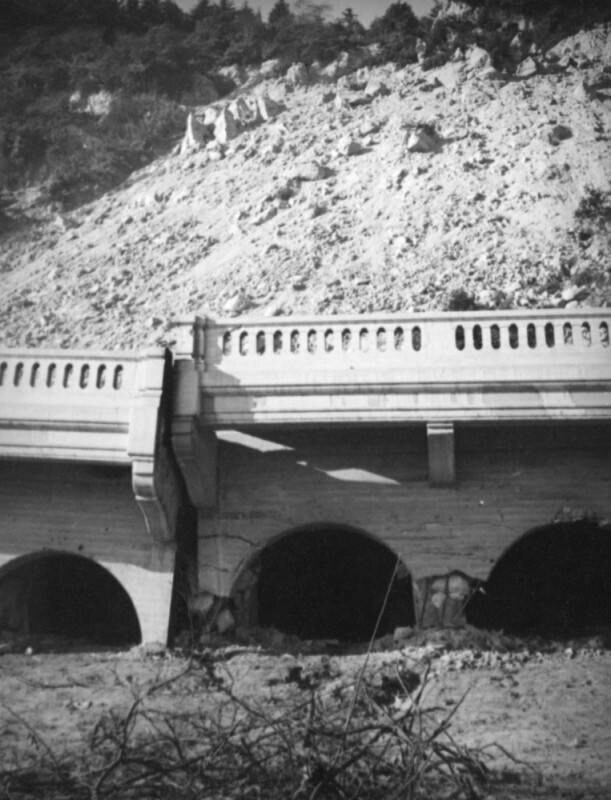
Dirt and rocks have broken Riverside Drive in two after the Elysian Park landslide. The abutments of the Riverside Drive-Dayton Avenue Bridge are crumbling.The Elysian Park landslide, which started near the top of Point Grand View (Buena Vista Peak) as a small crack in the earth and grew to 500-foot fissure over three weeks, culminated on November 26, 1937 when a million and a half tons of loose rock and dirt created a "moving mountain" destroying a 600-foot stretch of Riverside Drive. Dayton Avenue (later N. Figueroa Street) has had three different bridges. The Riverside Drive-Dayton Avenue Bridge first built in 1903 was replaced with a concrete one completed in 1928. In 1939, after the Elysian Park landslide and heavy floods in 1938, the Army Corps of Engineers built a replacement bridge with steel trussing, known as the Riverside Drive Bridge (Riverside-Figueroa Bridge) that was demolished in 2011.
Comments (0)
Register or login to comment and contribute to the community


