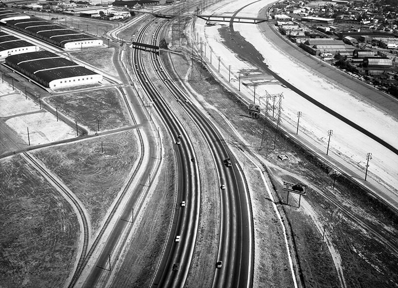
Long Beach (710) Freeway, looking southeast
1961
1 0
 United States > California > Los Angeles County > Bell
Aerial view of the Long Beach (710) Freeway in the city of Vernon view is looking southeast. The Los Angeles River is at right the 710 Freeway is bottom middle curving to top middle K St. parallels the freeway on the left 1st St. is middle left to center left 2nd St. is center left 3rd St. is upper left I St. and J St. are center left District Blvd. parallels the river on the right. The left of the 710 Fwy is Bell, and the right of the river is Vernon. Photograph was taken for Silver & MacWilliams. Photograph dated June 3, 1961.
Comments (0)
Register or login to comment and contribute to the community


