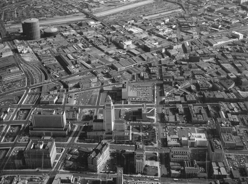
Aerial view of Civic Center, looking southeast
1956
0 0
 United States > California > Los Angeles County > Los Angeles
Aerial view of Los Angeles Civic Center, looking east toward City Hall. The Hollywood (101) Freeway runs vertically along the left, Temple Street is on the left of City Hall 1st Street is to the right of City Hall 2nd Street is vertically along the right North Broadway is at forefront followed by Spring Street, Main Street, San Pedro Street, and Alameda Street (middle left to upper right) Los Angeles River is visible at top. Photograph dated November 14, 1956.
Comments (0)
Register or login to comment and contribute to the community


Nearby photos


Image used under "Fair Use" conditions