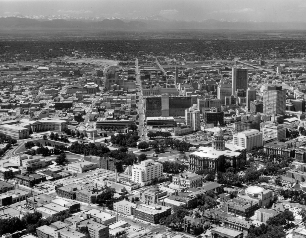
Aerial view of downtown Denver
1959
POPULAR
0 0
 United States > Colorado > Denver County > Denver
Aerial view of the central business district and Civic Center neighborhood of Denver, Colorado. Shows the Denver City and County Building, Colorado State Capitol Building, Civic Center, Denver Public Library, Carnegie Building, United States Mint, Scottish Rite Masonic Temple, Capitol Life Insurance Company Building, Farmers Union Building, Petroleum Building, Brown Palace Hotel, Mile High Center, Trinity Place, First National Bank Building, Denver Club Building, Republic Building, Majestic Building, Metropolitan Building, Daniels and Fisher Tower, Mountain States Telephone Building, Denver Gas and Electric Building, the Denver City Auditorium, and the Denver City and County Annex building. The foothills of the Front Range are in the distance.
Comments (0)
Register or login to comment and contribute to the community


