Early Eagle Rock panorama
1915
2 0
 Estados Unidos > California > Los Angeles County > Glendale
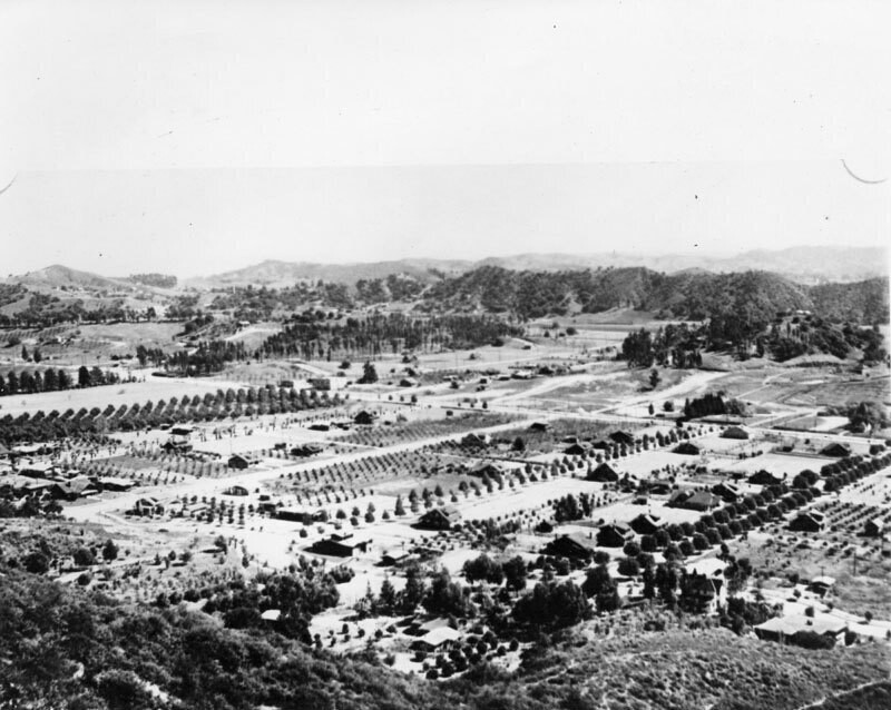
Panoramic view of Eagle Rock valley, as it was known in the 1900s, looking south and east from the hills in back of Hill Drive. Colorado Boulevard, a major east-west thoroughfare, can be seen running along the middle of the photo. The streets running in a north-south direction are possibly (l to r): Dahlia Dr., Townsend Ave., Vincent Ave., Mt. Royal Dr., La Roda Ave., and Argus Drive. Eagle Rock is a neighborhood in northeastern Los Angeles that derives its name from a massive boulder at the district's northern edge. The boulder contains an indentation that creates an eagle-shaped shadow everyday around noon. In the 1880s Eagle Rock existed as a farming community with grand Victorian farmhouses and many exquisite Craftsman homes in charming neighborhoods. In 1906 Eagle Rock became an independent city and was incorporated in 1911 with a population of approximately 600 in 1914 it also became home to Occidental College, designed by famed architect Myron Hunt.
Comentarios (0)
Regístrate o loguéate para poder comentar y aportar tu granito de arena


Fotos cercanas


Imagen utilizada mediante las condiciones "Fair Use"