Downtown aerial, looking east

1957
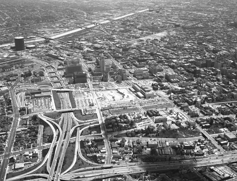
Downtown aerial, looking east

0 0 

Estados Unidos Estados Unidos > California > Los Angeles County > Los Angeles
Aerial view of Los Angeles Civic Center view is looking east. The Hollywood Freeway (101) is visible on the left, City Hall is in the middle, the Los Angeles River can be seen running along the top, and the Harbor Freeway (110) runs along the bottom. The construction site at center is located between Hill, Temple, Grand and 1st street and will be the L.A. County Superior Court building. Photograph dated May 4, 1957.
Comentarios (0)


Regístrate o loguéate para poder comentar y aportar tu granito de arena 

avatar

josh63 
934 fotos

108th Street at the S.W. corner of Broadway195 Broadway at the corner of Dey Street. New York Telephone and Telegraph BuildingWest 141st Street at the N.E. corner of Broadway. Apartment houseRussian Orthodox Church (New)252 West 85th Street. Apartment building


Fotos cercanas

Belmont High School constructionDowntown aerial, looking eastNorth Beaudry Avenue323 North Beaudry AvenueAbie's placeFour level interchangeHarbor FreewayFour level intersectionBunker Hill building constructionHollywood and Harbor freeway interchange

Foto publicada el
 28 de diciembre de 2019 a las 03:19


© Howard D. Kelly
Todos los derechos reservados

Imagen utilizada mediante las condiciones "Fair Use"


Fotos antiguas de Los Angeles,Fotografías antiguas de Los Angeles,Imágenes antiguas de Los Angeles,Instantáneas antiguas de Los Angeles,Panorámicas antiguas de Los Angeles,Estampas antiguas de Los Angeles