Rio Hondo River

1967
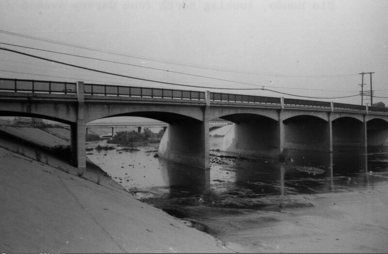
Rio Hondo River

2 0 

États-Unis États-Unis > California > Los Angeles County > Montebello
View of the Rio Hondo, looking north from Garvey Avenue towards Rosemead. The Rio Hondo is a 20 mile tributary of the Los Angeles River, which passes through several cities in Los Angeles County. As seen here, most of the river flows in a concrete-lined channel to serve a flood control function, but in two places the river does not flow over conrete, the Peck Road Water Conservation Park and the Whittier Narrows Recreation Area. Photo dated: September, 1967.
Commentaires (1)

avatar

emilia_cl 20/03/2020 07:07

Brilliant


S'inscrire ou connexion commenter et contribuer à la communauté 

avatar

landon_ice 
833 clichés

Las Campanas HospitalIsaac Brokaw house45 East 75th Street. Double red brick residence.449-453 West 123rd Street. The Benmore Apartment HousesEast 86th Street. Christmas tree in wartime, Carl Schurz Park


Photos des environs

Rio Hondo, looking southRio Hondo bridgeRio Hondo channelGarvey AvenueRosemead City HallPacific Express streetcar accidentGarvey AvenueEl Monte Drive-In, looking northeastEl Monte Drive-In, looking northFacade breaks away from building during quake

Photo publiée sur
 04/01/2020 21:27


© Security Pacific National Bank
Tous droits réservés

Image utilisée dans les conditions de "Fair Use


Vieilles photos de Montebello,Photographies anciennes de Montebello,Vieilles images de Montebello,Vieux clichés de Montebello,Anciennes vues panoramiques de Montebello,Anciennes gravures de Montebello