National Boulevard

1956

National Boulevard

0 0 

États-Unis États-Unis > California > Los Angeles County > Los Angeles
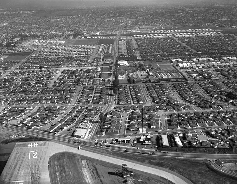
Aerial view of Santa Monica view is looking east. Photograph shows the vicinity of Santa Monica Airport (along bottom) and the intersection of National Boulevard (running up through the center) and Bundy Drive (horizontally along the lower portion). Bundy Drive turns into S. Centinela Avenue father on the right (not visible from this angle). Photographed for Tidewater Oil Association on January 28, 1956.
Commentaires (0)


S'inscrire ou connexion commenter et contribuer à la communauté 

avatar

josh63 
934 clichés

108th Street at the S.W. corner of BroadwayWest 141st Street at the N.E. corner of Broadway. Apartment house195 Broadway at the corner of Dey Street. New York Telephone and Telegraph BuildingRussian Orthodox Church (New)252 West 85th Street. Apartment building


Photos des environs

Whitaker RanchBundy Drive and National Boulevard, looking eastWhitaker ranch in Santa MonicaBundy Drive and National Boulevard, looking eastBundy Drive and Ocean Park Boulevard, looking northeastSanta Monica AirportBundy Drive and Ocean Park Boulevard, looking northBundy Drive, Centinela Avenue, looking southBundy Drive, looking northBundy Drive turns into Centinela Avenue

Photo publiée sur
 18/03/2019 11:19


© Howard D. Kelly
Tous droits réservés

Image utilisée dans les conditions de "Fair Use


Vieilles photos de Los Angeles,Photographies anciennes de Los Angeles,Vieilles images de Los Angeles,Vieux clichés de Los Angeles,Anciennes vues panoramiques de Los Angeles,Anciennes gravures de Los Angeles