Westchester district
1947
1 0
 États-Unis > California > Los Angeles County > Los Angeles
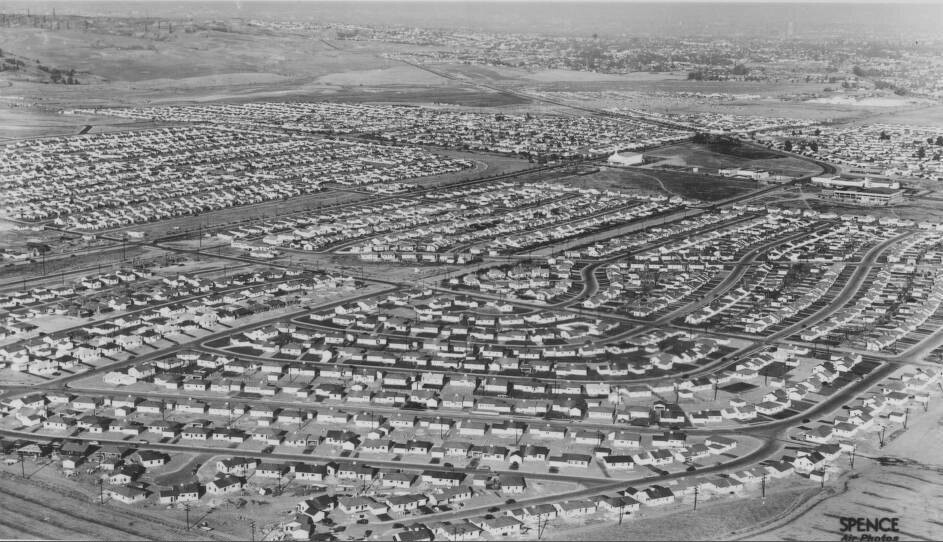
An aerial photograph of Westchester, looking to the northeast from Los Angeles International Airport. Westchester is an area of west Los Angeles, bordered by Playa del Rey on the west, Inglewood on the east, El Segundo on the south, and Jefferson and Centinela Boulevards on the north. At the start of the twentieth century, Westchester was primarily an agricultural area, but in 1928, the Los Angeles City Council selected Westchester as the site of a new airport, named Mines Field. The name later changed to Los Angeles Airport in 1941, and finally to Los Angeles International Airport in 1949, although it is often referred to simply as "LAX." In the years that followed, the airport expanded, occupying much of the southern part of Westchester. In the late 1930s, real estate developer Fritz Burns developed a tract of inexpensive, prefabricated single-family homes at the intersection of Manchester and Sepulveda Boulevards.
Commentaires (0)
S'inscrire ou connexion commenter et contribuer à la communauté


Photos des environs


Image utilisée dans les conditions de "Fair Use