Aerial view of Denver
1962
POPULAIRE
1 0
 États-Unis > Colorado > Denver County > Denver
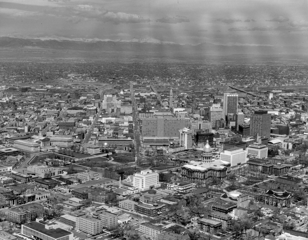
1960 May 2. Aerial view of Denver, Colorado. Shows Civic Center park, the Colorado State Capitol Building, Denver City and County Building, Farmers Union Building, Petroleum Building, Mile High Center, Brown Palace Hotel, First National Bank Building, Republic Building, Metropolitan Building, Majestic Building, Hilton Hotel, Mountain States Telephone Building, Denver Gas and Electric Building, Denver Public Library, Carnegie Building, Daniels and Fisher Tower, Denver City Auditorium, Voorhies Monument, and Colonnade of Benefactors. The Front Range is in the distance.
Commentaires (0)
S'inscrire ou connexion commenter et contribuer à la communauté


Photos des environs


Image utilisée dans les conditions de "Fair Use