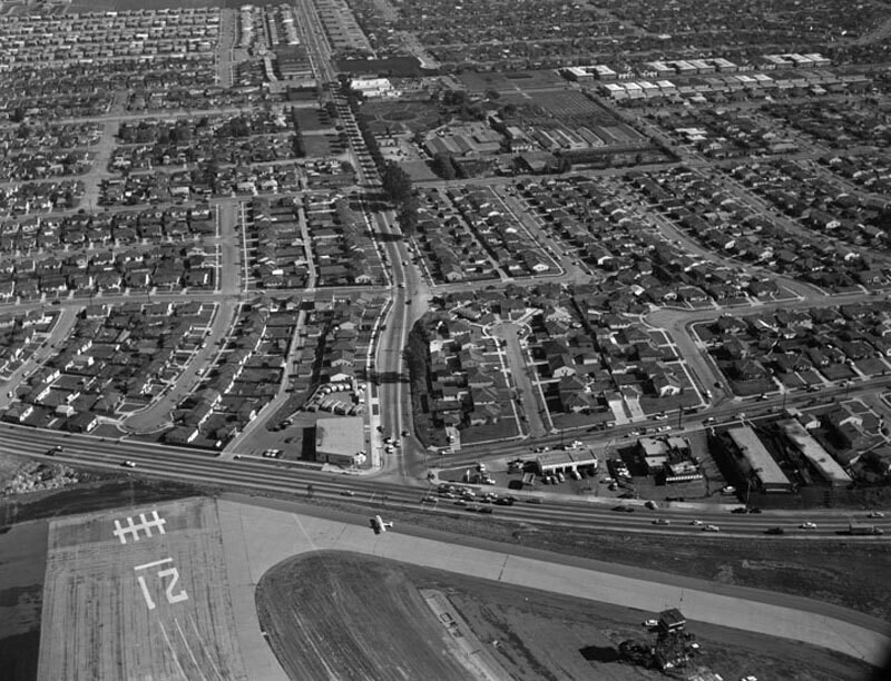
Bundy Drive and National Boulevard, looking east
1956
0 0
 Stati Uniti > California > Los Angeles County > Los Angeles
Aerial view of Santa Monica view is looking east. Photograph shows the vicinity of Santa Monica Airport (along bottom) and the intersection of National Boulevard (running up through the center) and Bundy Drive (horizontally along the lower portion). Bundy Drive turns into S. Centinela Avenue father on the right (not visible from this angle). Photographed for Tidewater Oil Association on January 28, 1956.
Commenti (0)
Registrati ovvero accesso commentare e contribuire alla comunità


Foto nelle vicinanze


Immagine utilizzata in condizioni di "Fair Use".