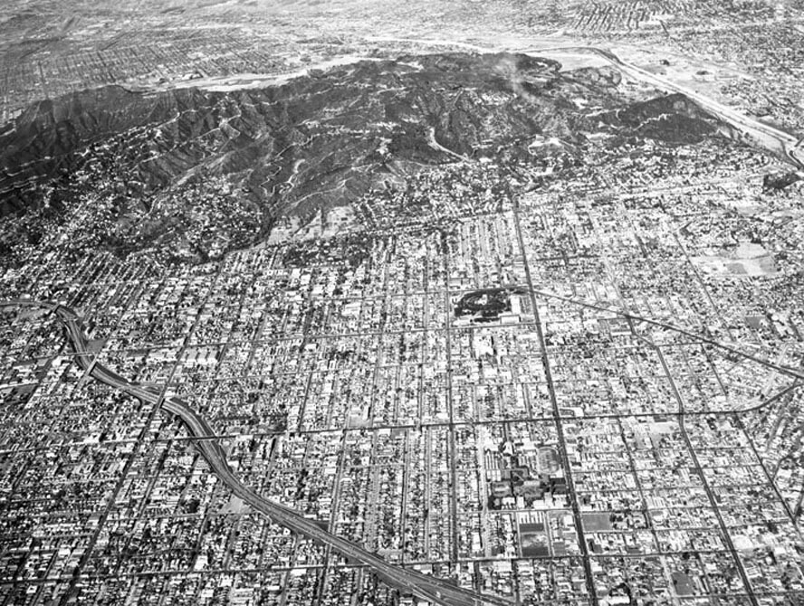
Aerial view of Los Angeles and surrounding vicinity, looking north
1956
0 0
 Stati Uniti > California > Los Angeles County > Los Angeles
Aerial view of Los Angeles and surrounding vicinity view is looking north. Some identifiable areas include: Hollywood (101) Freeway, bottom middle to middle left Melrose Avenue, horizontally at bottom Los Angeles City College, lower right at intersection of Santa Monica and Vermont Santa Monica Boulevard, horizontally, lower middle Sunset Boulevard, horizontally mid-photo Barnsdale Park, right of center at intersection of Sunset and Vermont Hollywood Boulevard, horizontally above Barnsdale Park Los Feliz Boulevard, horizontally, just below the mountain Griffith Observatory, upper center Griffith Park (mountains).
Commenti (0)
Registrati ovvero accesso commentare e contribuire alla comunità


Foto nelle vicinanze


Immagine utilizzata in condizioni di "Fair Use".