Bundy Drive turns into Centinela Avenue

1956

Bundy Drive turns into Centinela Avenue

0 0 

Stati Uniti Stati Uniti > California > Los Angeles County > Los Angeles
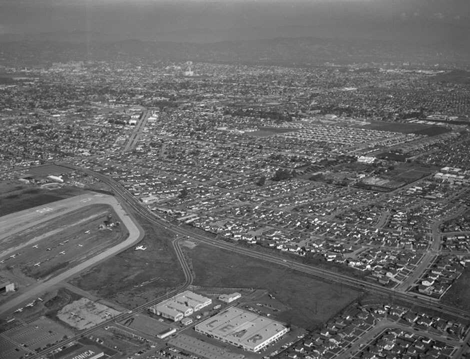
Aerial view of Santa Monica view is looking northeast. Photograph shows the vicinity of Santa Monica Airport (forefront) with Bundy Drive (mid-left to lower right). Ocean Park Boulevard is visible on upper left (jagged, double-lane street) National Boulevard lies mid-photo (horizontal tree-lined street, mid-photo to upper right) the wide street on the extreme right (curved) is possibly Stanwood Drive. Bundy Drive turns into S. Centinela Avenue once past Stanwood Drive. Photographed for Tidewater Oil Association on January 28, 1956.
Commenti (0)


Registrati ovvero accesso commentare e contribuire alla comunità 

avatar

josh63 
934 foto

108th Street at the S.W. corner of BroadwayWest 141st Street at the N.E. corner of Broadway. Apartment house195 Broadway at the corner of Dey Street. New York Telephone and Telegraph BuildingRussian Orthodox Church (New)252 West 85th Street. Apartment building


Foto nelle vicinanze

Vintage fighter plane crashes into houseSanta Monica AirportNational BoulevardWhitaker RanchWhitaker ranch in Santa MonicaBundy Drive, looking northBundy Drive and Ocean Park Boulevard, looking northeastBundy Drive and Ocean Park Boulevard, looking northBundy Drive and National Boulevard, looking eastBundy Drive and National Boulevard, looking east

Foto pubblicata su
 01/11/2017 06:44


© Howard D. Kelly
Tutti i diritti riservati

Immagine utilizzata in condizioni di "Fair Use".


Vecchie foto di Los Angeles,Vecchie fotografie di Los Angeles,Vecchie immagini di Los Angeles,Vecchie istantanee di Los Angeles,Vecchie viste panoramiche di Los Angeles,Vecchie stampe di Los Angeles