Rio Hondo River

1967
Rio Hondo River

2 0 

アメリカ アメリカ > California > Los Angeles County > Montebello
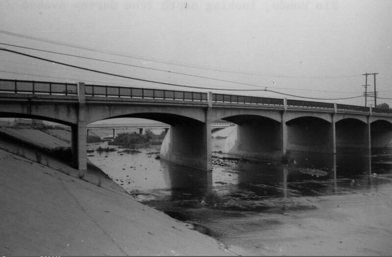
View of the Rio Hondo, looking north from Garvey Avenue towards Rosemead. The Rio Hondo is a 20 mile tributary of the Los Angeles River, which passes through several cities in Los Angeles County. As seen here, most of the river flows in a concrete-lined channel to serve a flood control function, but in two places the river does not flow over conrete, the Peck Road Water Conservation Park and the Whittier Narrows Recreation Area. Photo dated: September, 1967.
注釈 (1)

avatar

emilia_cl 20/03/2020 07:07

Brilliant


登録 または ログインする コメントし、社会に貢献する 

avatar

landon_ice 
833 写真

Las Campanas HospitalIsaac Brokaw house45 East 75th Street. Double red brick residence.449-453 West 123rd Street. The Benmore Apartment HousesEast 86th Street. Christmas tree in wartime, Carl Schurz Park


近くの写真

Rio Hondo, looking southRio Hondo bridgeRio Hondo channelGarvey AvenueRosemead City HallPacific Express streetcar accidentGarvey AvenueEl Monte Drive-In, looking northeastEl Monte Drive-In, looking northFacade breaks away from building during quake

写真上に公開
 04/01/2020 21:27


© Security Pacific National Bank
全著作権所有

「公正使用」条件下で使用した画像


Montebelloの古写真,Montebelloの古写真,Montebelloの古いイメージ,Montebelloの古いスナップショット,Montebelloのオールドパノラマの景色,Montebelloのオールドプリント