Aerial view of Lynwood
1926
0 0
 アメリカ > California > Los Angeles County > Lynwood
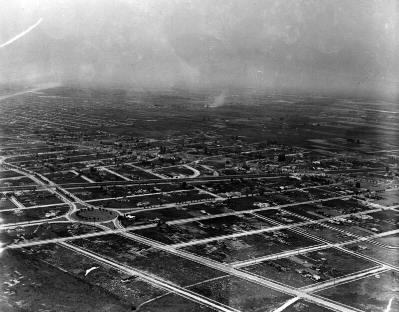
Aerial view showing Lynwood in 1926, five years after it was incorporated. Residential dwellings and other buildings are visible throughout, and predominantly empty roads appear as neatly spaced grids. Lynwood is a 4.9 square mile city, located in the southern portion of the Los Angeles Basin, in Los Angeles County. Its history dates back to 1810, when Don Antonio Lugo received a grant to a 29,514-acre tract of land, which he named Rancho San Antonio. On July 24, 1847 Don Lugo received a patent from the U.S government making him the undisputed owner of Rancho San Antonio. After Lugo's death in 1860, his five children inherited the ranch, which was equally divided between them. The families who first came to the Lynwood territory arrived in the late 1870s and early 1880s. By 1902, C.H. Sessions had acquired the title to approximately 400 acres of this land, and he established "the Lynwood Diary and Creamery", named after his wife's maiden, Miss Lynne Wood.


gussy80 21/04/2020 12:56
Put some more on!