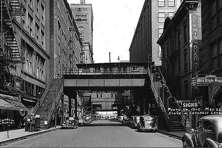
Congress Parkway (Ida B. Wells Drive) and State Street, view east
1939
2 1
 アメリカ > Illinois > Cook County > Chicago
In 1893, Chicago began operating its first L line, running from downtown through the South Side to the south terminal of the Columbian Exposition in Jackson Park. The northern terminus of the line was Congress Boulevard, in an alley between State Street and Wabash Avenue. The elevated Loop facility was built in 1900, but the dead-end terminal at Congress was retained to provide additional service during peak hours. A 1939 photo shows the original stub terminal, followed by tracks leading to the loop on the Wabash. The Congressional Short Terminal was closed and demolished in 1949. In the 1950s, this portion of Congress Boulevard was converted into a six-lane highway. Instead of demolishing the Auditorium and other buildings along the street, the roadway was widened to the property line and pedestrian galleries cut through the buildings.
注釈 (0)


