Glendale aerial

1927

Glendale aerial

0 0 

アメリカ アメリカ > California > Los Angeles County > Glendale
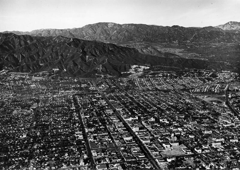
Aerial view of Glendale looking north toward the Verdugo Mountains. Glendale Ave. curves at the right towards Verdugo Canyon. Brand Blvd. runs straight to the feet of the mountains. La Canada, La Crescenta area and the San Gabriel Moutains are in the background. Photo dated: Nov. 15, 1927.
注釈 (0)


登録 または ログインする コメントし、社会に貢献する 

avatar

wyatt 
872 写真

124th St., east from Broadway, New York.Arial view to Gateway Shopping CenterB.S. Moss Hamilton Theatre135th St., west from Broadway, New York.West Carson aerial


近くの写真

Foxy's RestaurantBrand Boulevard and Colorado StreetFirst Church of Christ Scientist interiorFirst Church of Christ Scientist in GlendaleIndustrial paradeGlendale TheaterBrand BoulevardGlendale aerialBrand BoulevardBrand Boulevard and Broadway

写真上に公開
 05/05/2019 21:21


© Spence Air Photos
全著作権所有

「公正使用」条件下で使用した画像


Glendaleの古写真,Glendaleの古写真,Glendaleの古いイメージ,Glendaleの古いスナップショット,Glendaleのオールドパノラマの景色,Glendaleのオールドプリント