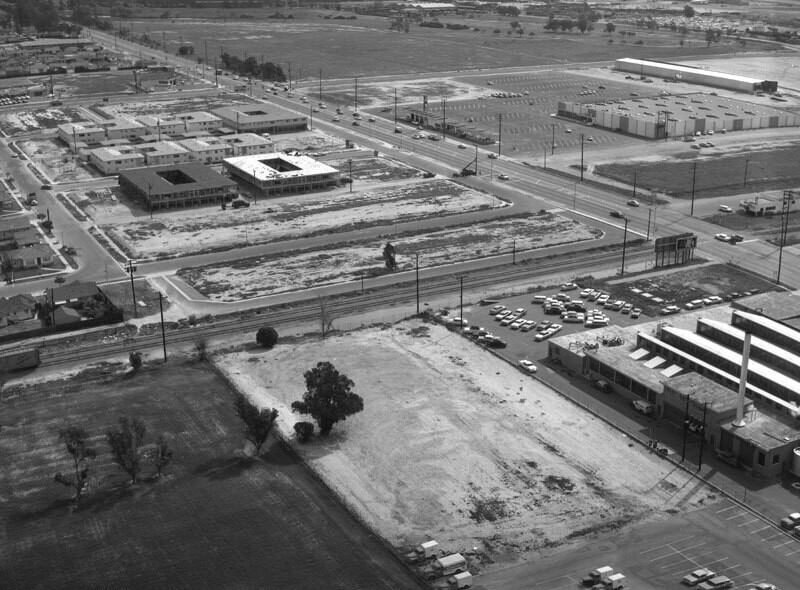
Greenmeadow Road, looking southeast
1960
2 0
 アメリカ > California > Los Angeles County > Long Beach
Aerial view of a lot at the intersection of Carson Street (diagonally, top left corner to middle right) and Paramount Boulevard (diagonally, upper left to top right) corner view is looking southeast. A warehouse with a "Cal" sign is visible at upper right, the Union Pacific Railroad tracks run from lower left to middle right, and a small section of All Souls Cemetery is at forefront. Photograph taken for Meg - Bob Brindle. Photograph dated February 26, 1960.
注釈 (0)


