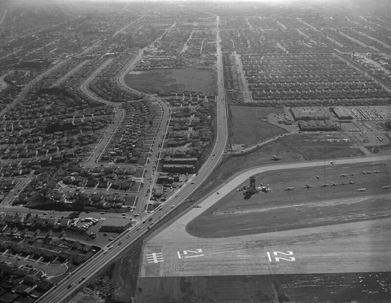
Bundy Drive, Centinela Avenue, looking south
1956
0 0
 アメリカ > California > Los Angeles County > Santa Monica
Aerial view of Santa Monica view is looking south. Photograph shows the vicinity of Santa Monica Airport (forefront) with Bundy Drive (left corner, running up the center). National Boulevard can be seen peeking out from the left and intersecting with Bundy Drive. The curved streets paralleling Bundy Drive are (r to l) Grand View Boulevard and Mountain View Avenue. Bundy Drive turns into S. Centinela Avenue once past Stanwood Drive (curved street next to the large empty plot, upper center). Photographed for Tidewater Oil Association on January 28, 1956.
注釈 (0)


