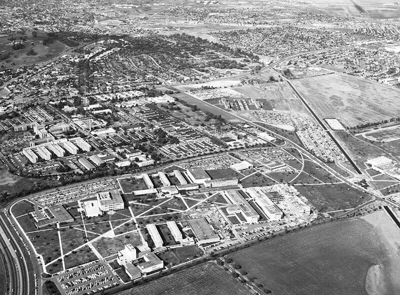
California State University, Long Beach, looking northwest
1960
0 0
 アメリカ > California > Los Angeles County > Long Beach
Aerial view of Cal State University, Long Beach, located at 1250 Bellflower Blvd. (lower left to center right), as well as Veterans Affairs Medical Center - Long Beach (middle left) view is looking northwest. 7th Street is at extreme bottom left corner Beach Drive is lower right to upper left Atherton Street is upper right to upper left Bellflower Boulevard curves from middle left to top right W. Campus Road is middle left to center right E. Campus Road is bottom left to lower right. Photograph dated November 4, 1960.
注釈 (0)


