Bandini Boulevard, looking east

1956
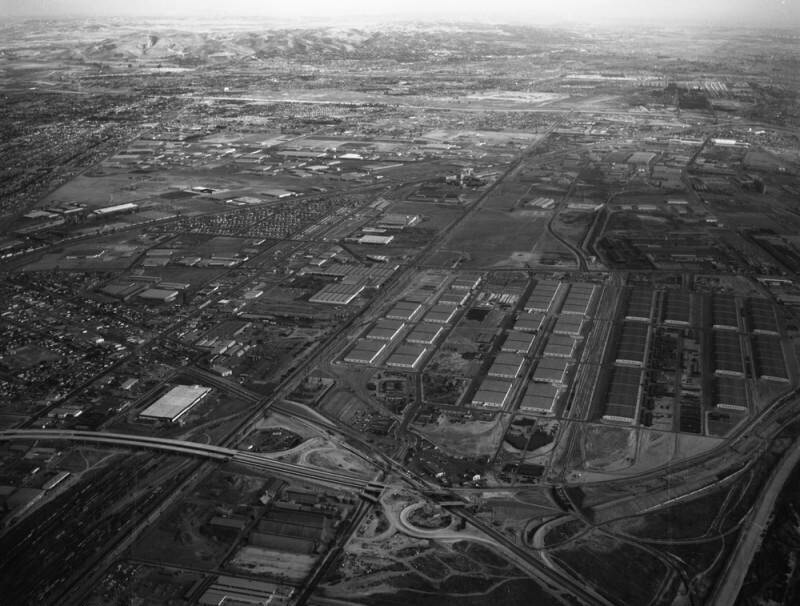
Bandini Boulevard, looking east

0 0 

アメリカ アメリカ > California > Los Angeles County > Vernon
Aerial view of the Central Manufacturing District, located within the cities of Commerce, Bell, and Vernon view is looking east. Some identifiable areas include: (l to r) Telegraph Road and Santa Ana Freeway (5), diagonally middle left to top right Washington Boulevard, lower left to middle top Atchison Topeka & Santa Fe rail yards, lower left to top middle Bandini Boulevard, vertically lower middle to middle top and (bottom to top) a section of the yet-unfinished Long Beach (710) Freeway, two white lines horizontally at forefront Atlantic Boulevard from middle left, to bottom right Cheli Air Force Station at center Eastern Avenue, horizontally at middle and Garfield Avenue, horizontally at upper middle. Photograph dated November 14, 1956.
注釈 (0)


登録 または ログインする コメントし、社会に貢献する 

avatar

emily66 
668 写真

Market Street store frontsJoseph G. Darlington and Company337 East 17th Street, north side, west of First AvenueSt. Gabriel's Park, looking N.W. across the Park from 35th Street vest of First AvenuePhiladelphia Old City Hall and American Philosophical Society Building


近くの写真

Cheli Air Force Depot, Commerce, looking eastPaving at Bandini and Atlantic boulevards, looking northeastBandini Boulevard, looking eastPaving at Bandini and Atlantic boulevards, looking eastPaving at Bandini and Atlantic boulevards, looking northCheli Air Force Depot, Commerce, looking eastPaving at Bandini and Atlantic boulevards, looking northPaving at Bandini and Atlantic boulevards, looking eastPaving at Bandini and Atlantic boulevards, looking northCheli Air Force Depot, Commerce, looking east

写真上に公開
 03/02/2020 19:01


© Howard D. Kelly
全著作権所有

「公正使用」条件下で使用した画像


Vernonの古写真,Vernonの古写真,Vernonの古いイメージ,Vernonの古いスナップショット,Vernonのオールドパノラマの景色,Vernonのオールドプリント