City of Compton, aerial view

1946
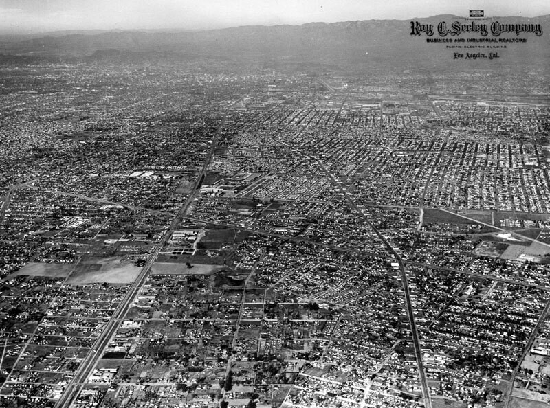
City of Compton, aerial view

0 0 

アメリカ アメリカ > California > Los Angeles County > Compton
An aerial view of the City of Compton, looking north of El Segundo Boulevard. Long Beach Boulevard is at right, and Alameda is to the left. Photo taken in 1946.
注釈 (1)

avatar

anjel 07/12/2019 10:53

I love it!


登録 または ログインする コメントし、社会に貢献する 

avatar

isaac_kleb
697 写真

Herb Lehr and Harry Daghlian transporting the plutonium core before the Trinity TestCasa de CadillacCasa de Cadillac showroomSubway Terminal BuildingCompton College sign


近くの写真

City of Compton, aerial viewAerial view of LynwoodEarthquake-damaged Lynwood TheatreDamaged Lynwood TheatreCompton, an aerial viewLynwood Theatre collapsedAerial view of the Bundy CorpCompton BoulevardFlower StreetMcDonald Hardware

写真上に公開
 27/05/2019 01:20


© Security Pacific National Bank
全著作権所有

「公正使用」条件下で使用した画像


Comptonの古写真,Comptonの古写真,Comptonの古いイメージ,Comptonの古いスナップショット,Comptonのオールドパノラマの景色,Comptonのオールドプリント