Aerial view of Denver

1956

Aerial view of Denver

0 0 

アメリカ アメリカ > Colorado > Denver County > Denver
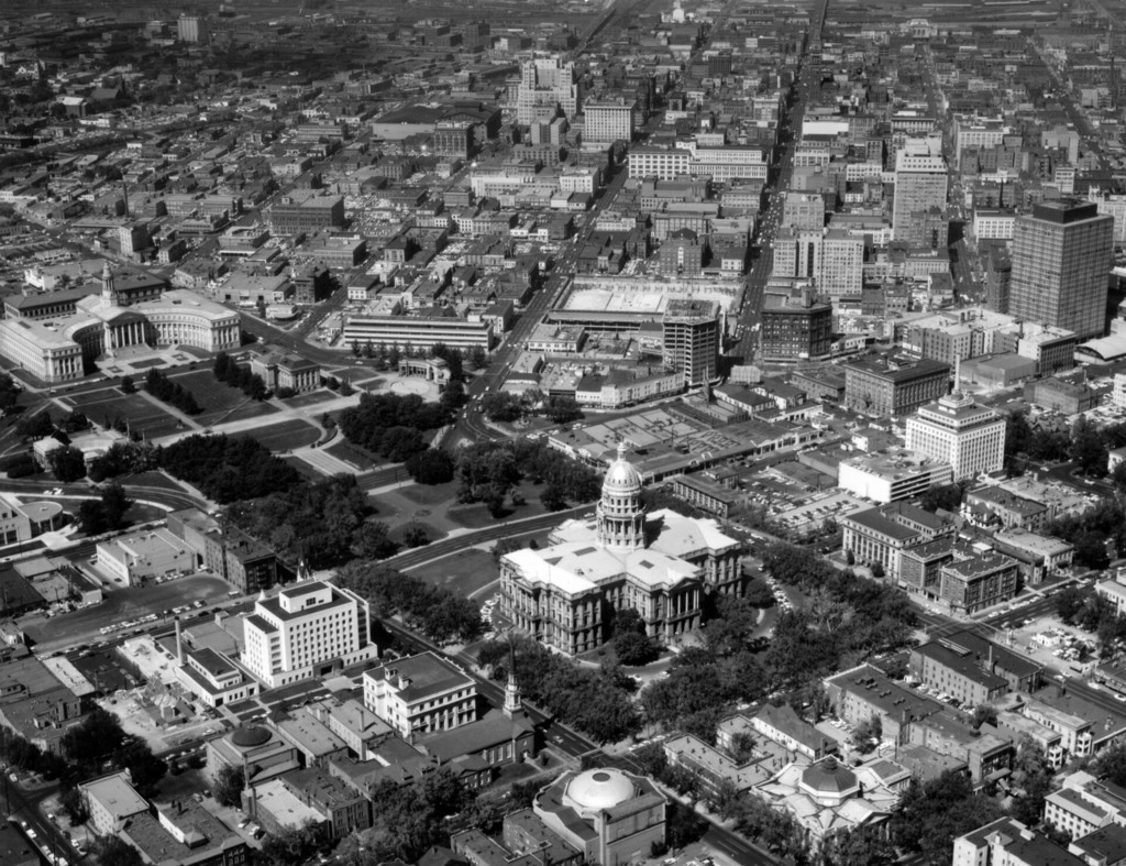
1956, September 14. Aerial view of Denver, Colorado. Shows Civic Center park, the Colorado State Capitol Building, Denver City and County Building, Petroleum Building, Farmers Union Building, Mile High Center, Brown Palace Hotel, Denver Public Library, Carnegie Building, Mountain States Telephone Building, Denver Gas and Electric Building, Daniels and Fisher Tower, Majestic Building, Colorado State Office Building, Argonaut Hotel, and Scottish Rite Masonic Temple. A large hole is excavated for the footings of the Hilton Hotel and May D & F.
注釈 (0)


登録 または ログインする コメントし、社会に貢献する 

avatar

sophy_tuck 
816 写真

Aerial view of Denver6033 Fieldston RoadAerial view of DenverBroadway, south from 180th StreetSixth Avenue


近くの写真

Aerial view of Capitol Hill and the central business district of DenverAerial view of downtown DenverAerial view of the central business district and Civic Center neighborhood of DenverAerial view of DenverArgonaut Hotel on the corner of Grant and Colfax Streets in DenverState Office Building, DenverAerial view of DenverCapitol building on a winter night, DenverDenver Public Library buildingAerial view of Denver

写真上に公開
 17/07/2019 12:54


© Otto Roach
全著作権所有

「公正使用」条件下で使用した画像


Denverの古写真,Denverの古写真,Denverの古いイメージ,Denverの古いスナップショット,Denverのオールドパノラマの景色,Denverのオールドプリント