Baldwin Hills Reservoir
1948
0 0
 アメリカ > California > Los Angeles County > Los Angeles
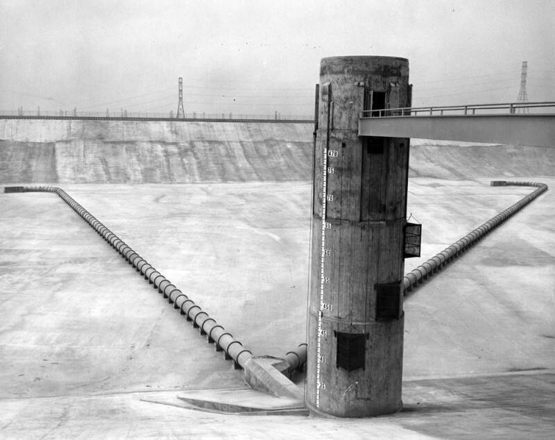
View of the Baldwin Hills Reservoir with the outlet tower in the foreground and inlet lines on the floor of the reservoir. Tower markings go from 435 to 478 feet and show elevations above sea level. Deepest part of reservoir is 66 feet below highest level shown on tower.On December 14, 1963, the dam collapsed, spilling 300 million gallons of water into the hillsides that swept away houses and cars and left three dead. Most of Baldwin Village, including the historic Village Green community, was flooded as well. The crack in the dam was ultimately attributed to subsidence caused by overexploitation of the Inglewood oil field. The disaster caused the Los Angeles Department of Water & Power to phase out small local reservoirs, opting instead to store water in groundwater basins and behind the Hansen Dam in Lake View Terrace.
注釈 (0)


