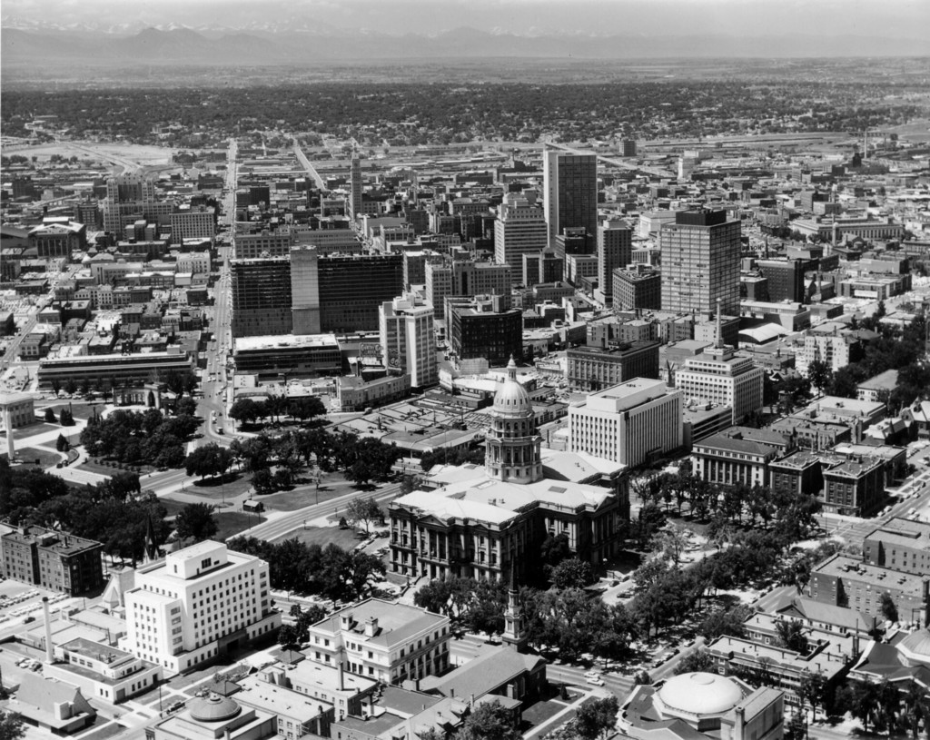
Aerial view of the central business district and Civic Center neighborhood of Denver
1959
POPULAIR
0 0
 Uruguay > Colorado > Denver County > Denver
Aerial view of the central business district and Civic Center neighborhood of Denver, Colorado. Shows the Colorado State Capitol Building, Mile High Center, Farmers Union Building, Capitol Life Insurance Company Building, Brown Palace Hotel, Petroleum Building, Majestic Building, Republic Building, Metropolitan Building, Mountain States Telephone Building, Denver Gas and Electric Building, Denver Municipal Auditorium, Trinity Place, Shirley-Savoy Hotel, First National Bank building, Daniels and Fisher Tower, United States Post Office, United States Customs House, and the Hilton Hotel under construction. A rocket sits on the lawn of Civic Center park near the Voorhies Memorial. The foothills of the Front Range are in the distance.
Reacties (0)
Registreren of inloggen om commentaar te geven en bij te dragen aan de gemeenschap


Nabijgelegen foto's


Beeld gebruikt onder "Fair Use" voorwaarden