Santorini
1972
POPULAR
0 0
 Greece > Aegean > Thira Regional Unit > Thira Municipal Unit
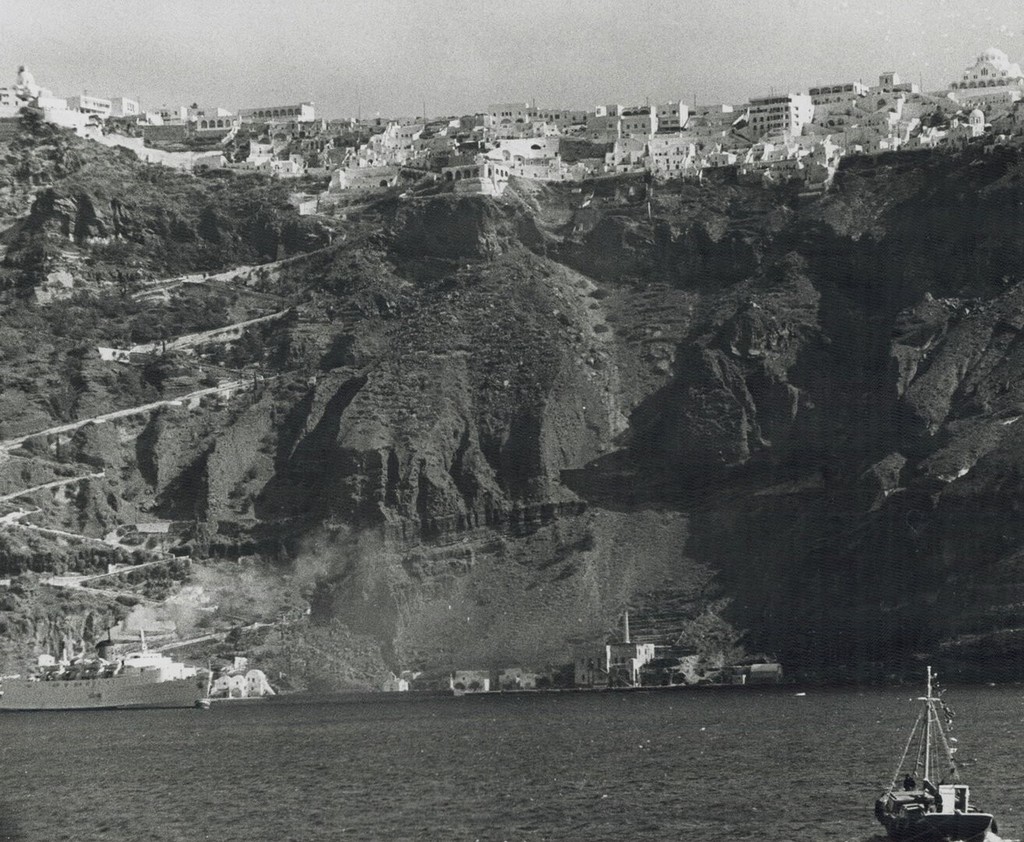
Santorini 1972 from sea . Santorini is essentially what remains after an enormous volcanic eruption that destroyed the earliest settlements on a formerly single island, and created the current geological caldera. A giant central, rectangular lagoon, which measures about 12 by 7 km (7.5 by 4.3 mi), is surrounded by 300 m (980 ft) high, steep cliffs on three sides. The main island slopes downward to the Aegean Sea. On the fourth side, the lagoon is separated from the sea by another much smaller island called Therasia, the lagoon is connected to the sea in two places, in the northwest and southwest. The depth of the caldera, at 400m, makes it impossible for any but the largest ships to anchor anywhere in the protected bay, there is also a fisherman's harbour at Vlychada, on the southwestern coast.
Regístrate o loguéate para poder comentar y aportar tu granito de arena


Fotos cercanas


Imagen utilizada mediante las condiciones "Fair Use"
william_1795 14 de octubre de 2019 a las 15:24
I like it!
konstantinina 18 de febrero de 2020 a las 08:15
Όταν ήμουν νέος συνήθιζα να πηγαίνω εκεί πολύ