Glendale aerial

1927

Glendale aerial

0 0 

United States United States > California > Los Angeles County > Glendale
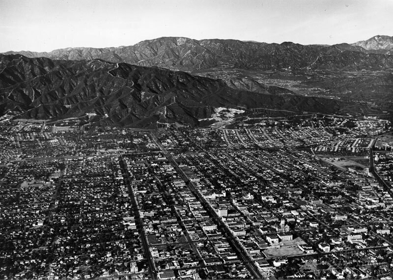
Aerial view of Glendale looking north toward the Verdugo Mountains. Glendale Ave. curves at the right towards Verdugo Canyon. Brand Blvd. runs straight to the feet of the mountains. La Canada, La Crescenta area and the San Gabriel Moutains are in the background. Photo dated: Nov. 15, 1927.
Comentarios (0)


Regístrate o loguéate para poder comentar y aportar tu granito de arena 

avatar

wyatt 
803 fotos

124th St., east from Broadway, New York.B.S. Moss Hamilton TheatreArial view to Gateway Shopping Center135th St., west from Broadway, New York.West Carson aerial


Fotos cercanas

Foxy's RestaurantBrand Boulevard and Colorado StreetFirst Church of Christ Scientist interiorFirst Church of Christ Scientist in GlendaleIndustrial paradeGlendale TheaterBrand BoulevardGlendale aerialBrand BoulevardBrand Boulevard and Broadway

Foto publicada el
 5 de mayo de 2019 a las 21:21


© Spence Air Photos
Todos los derechos reservados

Imagen utilizada mediante las condiciones "Fair Use"


Old photos of Glendale,Old photographs of Glendale,Old images of Glendale,Old snapshots of Glendale,Old panoramic views of Glendale,Old prints of Glendale