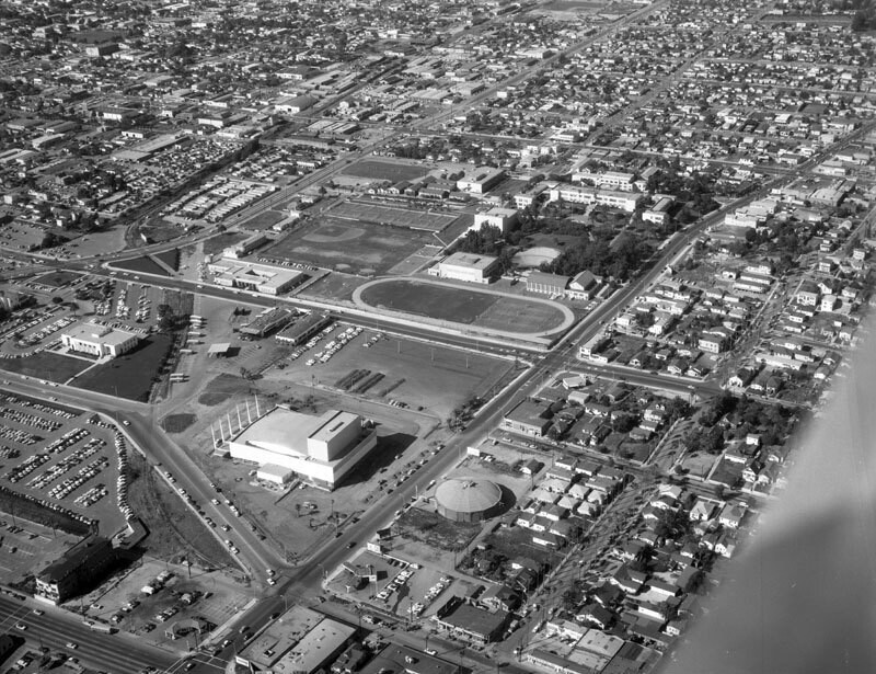
Santa Monica Civic Auditorium, looking north
1958
1 0
 United States > California > Los Angeles County > Santa Monica
Aerial view of a section of Santa Monica showing the Ocean Park Arena (across Pico Blvd. from auditorium), Santa Monica Civic Auditorium (square white building at center, Welton Beck and Associates, Architects), Santa Monica High School and Memorial Open Air Theater (at upper center) view is looking slightly northeast. Pico Boulevard runs diagonally from bottom left to top right Neilson Way peeks out from bottom left corner Main Street zig-zags from middle left to botom right 3rd street from center to middle right 4th street runs from middle left to middle right, between high school track and auditorium property the Santa Monica (10) Freeway is visible from middle left to top right and is paralleled by Olympic Boulevard on the left. Photograph was taken for Pioneer Flintkote. Photograph dated May 1, 1958.
Regístrate o loguéate para poder comentar y aportar tu granito de arena


Fotos cercanas


Imagen utilizada mediante las condiciones "Fair Use"
jevremik 2 de febrero de 2020 a las 08:36
Those of us who passed through that area remember it well
samy85 18 de marzo de 2020 a las 07:57
Lovely photo