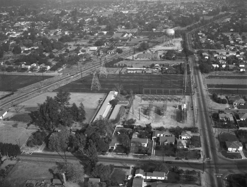
Walnut Grove Avenue, looking east
1955
0 0
 United States > California > Los Angeles County > Rosemead
Aerial view of property in the San Gabriel Valley, bordered by Walnut Grove Avenue on the west (the street visible running horizontally in the forefront), and the Southern Pacific RR tracks on the northeast, which are scheduled for re-zoning. View is looking east, with Grand Avenue (street running vertically along the right) the actual city is Rosemead. Photographed for Dwight Mathery on October 30, 1955.
Comentarios (0)
Regístrate o loguéate para poder comentar y aportar tu granito de arena


Fotos cercanas


Imagen utilizada mediante las condiciones "Fair Use"