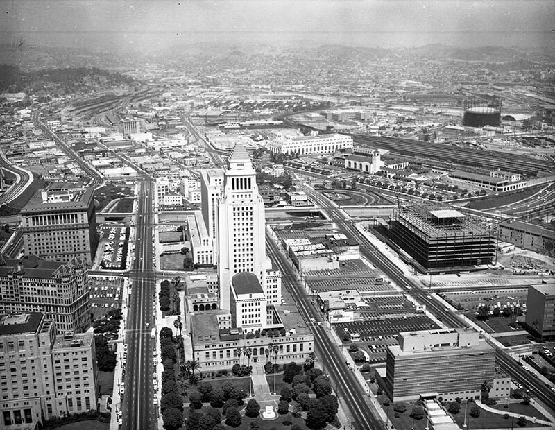
City Hall
1963
0 0
 United States > California > Los Angeles County > Los Angeles
Aerial view of Los Angeles Civic Center neighborhood of government offices view is looking northeast. Identifiable landmarks include the Hall of Records, the old County Courthouse and the Hall of Justice on the left Los Angeles City Hall, located at 200 N. Spring St. sits at forefront the Federal Building is under construction on the right, north of the LAPD headquarters (later Parker Center) the Santa Ana (101) Freeway is horizontally across the middle Union Passenger Terminal, located at 800 N. Alameda St. and the Post Office Terminal Annex are at center right Hill St., Broadway Spring St., Main St., Los Angeles St. and Alameda St. are vertically left to right Temple Street is horizontally at lower center Cesar Chavez Ave. is horizontally at upper center. Photograph was taken for Paul S. Sieto of Empire National Bank. Photograph dated August 5, 1963.
Regístrate o loguéate para poder comentar y aportar tu granito de arena


Fotos cercanas


Imagen utilizada mediante las condiciones "Fair Use"
gussy80 9 de marzo de 2020 a las 09:54
Beautiful