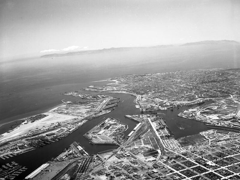
Los Angeles Harbor, looking southwest
1956
0 0
 United States > California > Los Angeles County > Los Angeles
Aerial view of the Los Angeles Harbor and Terminal Island view is looking southwest toward the Pacific Ocean. The East Basin is at lower left, flowing into East Basin Channel Turning Basin is at middle West Basin is at lower right the Los Angeles Main Channel at center, flows into the Pacific Ocean. Terminal Island is on middle left the city of San Pedro is at center right Cabrillo Beach and Point Fermin are visible at upper middle. Santa Catalina Island is present inthe background. Photograph dated May 7, 1956.
Regístrate o loguéate para poder comentar y aportar tu granito de arena


Fotos cercanas


Imagen utilizada mediante las condiciones "Fair Use"
dave_lt 20 de marzo de 2020 a las 20:59
I know that area well