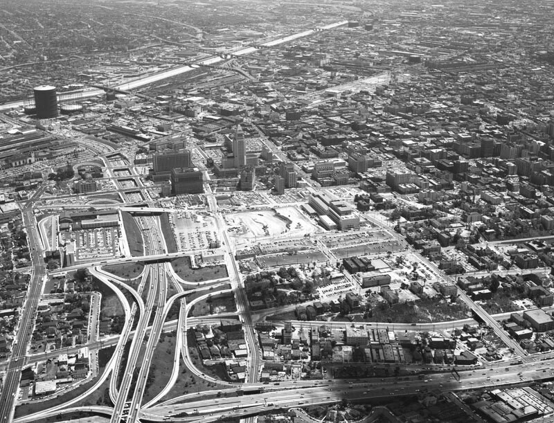
Downtown aerial, looking east
1957
0 0
 United States > California > Los Angeles County > Los Angeles
Aerial view of Los Angeles Civic Center view is looking east. The Hollywood Freeway (101) is visible on the left, City Hall is in the middle, the Los Angeles River can be seen running along the top, and the Harbor Freeway (110) runs along the bottom. The construction site at center is located between Hill, Temple, Grand and 1st street and will be the L.A. County Superior Court building. Photograph dated May 4, 1957.
Comentarios (0)
Regístrate o loguéate para poder comentar y aportar tu granito de arena


Fotos cercanas


Imagen utilizada mediante las condiciones "Fair Use"