Long Beach (710) Freeway, looking southeast

1961
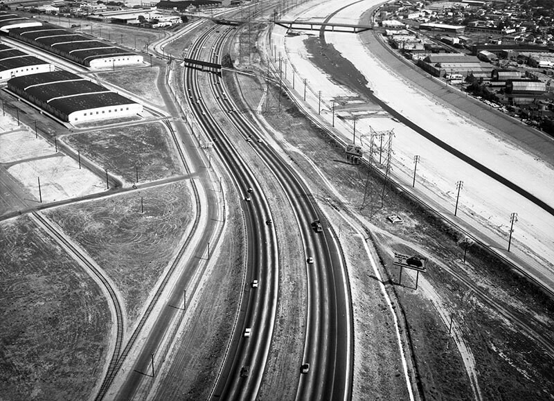
Long Beach (710) Freeway, looking southeast

1 0 

United States United States > California > Los Angeles County > Bell
Aerial view of the Long Beach (710) Freeway in the city of Vernon view is looking southeast. The Los Angeles River is at right the 710 Freeway is bottom middle curving to top middle K St. parallels the freeway on the left 1st St. is middle left to center left 2nd St. is center left 3rd St. is upper left I St. and J St. are center left District Blvd. parallels the river on the right. The left of the 710 Fwy is Bell, and the right of the river is Vernon. Photograph was taken for Silver & MacWilliams. Photograph dated June 3, 1961.
Comentarios (0)


Regístrate o loguéate para poder comentar y aportar tu granito de arena 

avatar

dave_lt 
729 fotos

Fountain Valley Drive-In siteAlvarado HotelSite of Gimbels Dept. Store - 33rd St.& 6th Ave. - Year 1898Long Beach (710) Freeway, looking northwestAftermath of a snowstorm.


Fotos cercanas

Long Beach (710) Freeway, looking southLong Beach (710) Freeway, looking southLong Beach Freeway, looking southeastPaving at Bandini and Atlantic boulevards, looking northThermador Electrical Manufacturing Co., looking northwestThermador Electrical Manufacturing Co., looking northwestCheli Air Force Depot, Commerce, looking eastPaving at Bandini and Atlantic boulevards, looking northThermador Electrical Manufacturing Co., looking southwestLong Beach (710) Freeway, looking northwest

Foto publicada el
 5 de septiembre de 2018 a las 14:14


© Howard D. Kelly
Todos los derechos reservados

Imagen utilizada mediante las condiciones "Fair Use"


Old photos of Bell,Old photographs of Bell,Old images of Bell,Old snapshots of Bell,Old panoramic views of Bell,Old prints of Bell