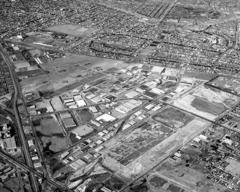
Vail Field, looking north
1955
0 0
 United States > California > Los Angeles County > Commerce
Aerial view of the Central Manufacturing District, located within the cities of Commerce, Bell, and Vernon view is looking northwest toward East Los Angeles. Some identifiable areas include: Ferguson Drive running slightly diagonal (separating the industrial area from the city) the Santa Ana (5) Freeway running diagonally along the left Telegraph Road paralleling the freeway Slauson Avenue running across bottom left corner crossing the 5 Freeway and Telegraph Road Washington Boulevard from middle left, curving toward lower right Garfield Avenue from bottom left winding up to top right and Vail Avenue running diagonally from bottom left to middle right. Numerous warehouses and buildings are scattered throughout. Photograph dated November 26, 1955.
Comentarios (0)
Regístrate o loguéate para poder comentar y aportar tu granito de arena


Fotos cercanas


Imagen utilizada mediante las condiciones "Fair Use"