Pacific Coast Highway

1997

Pacific Coast Highway

0 0 

Urugwaj Urugwaj > California > Los Angeles County > Santa Monica
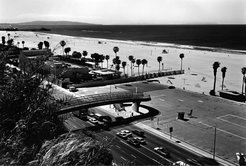
Looking over the Pacific Coast Highway from Santa Monica Bluffs, with the Jonathan Club, the pier, and Palos Verdes Peninsula visible in the upper left. A continuous stream of cars can be seen as they travel along PCH below the pedestrian bridge in contrast, the parking lot on the right is completely empty.
Komentarze (0)


Zarejestruj się na lub zaloguj się aby komentować i przyczyniać się do rozwoju społeczności 

avatar

dave_lt 
797 zdjęcia

Fountain Valley Drive-In siteAlvarado HotelSite of Gimbels Dept. Store - 33rd St.& 6th Ave. - Year 1898Aftermath of a snowstorm.Long Beach (710) Freeway, looking northwest


Zdjęcia w pobliżu

Looking toward beach from west of Montana AvenuePacific Coast Highway reconstructionJonathan Club beach124-126-130 Palisades Avenue138 Palisades AvenueBeach Club parking lot, Pacific Coast Highway, Santa Monica135 Palisades Avenue136 Alta AvenuePedestrian crossingPedestrian crossing, Pacific Coast Highway, Santa Monica

Zdjęcie opublikowane na stronie
 24/06/2017 11:01


© Anthony Friedkin
Wszystkie prawa zastrzeżone.

Zdjęcie użyte na warunkach "Fair Use".


Stare zdjęcia Santa Monica,Stare fotografie Santa Monica,Stare obrazy Santa Monica,Stare migawki z Santa Monica,Stare panoramiczne widoki na Santa Monica,Stare druki Santa Monica