National Boulevard
1956
0 0
 Urugwaj > California > Los Angeles County > Los Angeles
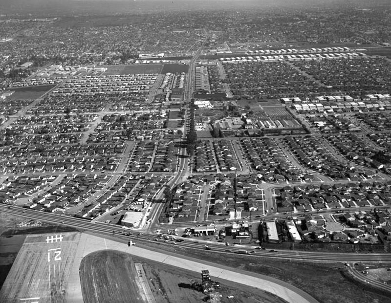
Aerial view of Santa Monica view is looking east. Photograph shows the vicinity of Santa Monica Airport (along bottom) and the intersection of National Boulevard (running up through the center) and Bundy Drive (horizontally along the lower portion). Bundy Drive turns into S. Centinela Avenue father on the right (not visible from this angle). Photographed for Tidewater Oil Association on January 28, 1956.
Komentarze (0)
Zarejestruj się na lub zaloguj się aby komentować i przyczyniać się do rozwoju społeczności


